All about tourism in Turkey

Turkey heaven on earth

in this post which I made it in whole week we will know about the prime tourism towns in turkey and you will find in this post general advices about turkey , air maps , prime advices , illustrative photos , tourism places and some videos .


I'll go back to the drawing board and we will explorer by photos all hotels (5 stars) that's which found in this citys and put link to web site related to every hotel to be aware of all information with more pictures .


and if you wanted to increase you information about turkey or was thinking of to travel to it because of tourism or relaxation so this post will help you so much .


general information

of course , we know that every country have specially mode from many directions , so we must have specific background about any country before we travel to these .

and the following points like clarification points , and some of it advices .

capital : Ankara religion : islam 99% water : preferable , don't drink faucet water prices : not cheap specially in tourism territory , lookout utilization , example : 1 liter gas at them it's price 2 bux approximately and that evidence on cost an arm and a leg people : like arabian people exactly from external appearance and religion , there's temperament irascible and heated , if you get into argument with seller about specific goods , maybe theylose one's temper and giving you the ax . food : eastern food , like arabian food the hotels prices : an example : journey for 4 days , in the tourism season will expense you between 500 - 900 bux , of course there is another factors, like travel in plane (sharter cheap ) and tourism deputy profit ratio .
the better go to local deputy to take idea, because perhaps the prices different between countrys

prices in Antalya airport : imagination , small coca cup xpense 11 bux ,mcdonald's meal expense 30 bux insurance : preferable pay tourism deputy commission before travel , because if you sicken and entered the hospital will not compel to pay 400 bux every night


the most important tourism citys in turkey

there is three prime citys attract tourists in turkey ,

and there is
  1. Antalya
  2. Bodrum
  3. istanbul

this pictures helps you to know the geographic position

for this citys , this pictures by google earth


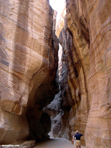
distinguish Antalya in : comfort weather , warm sun , waterfalls , various food , various tourism activities .

antalya gulf extend about 200km and his beach distinguish in beauty and splendor ,antalya port consider the beautifulest in turkey in antalya port territory we find many of restaurants , cafes and stores .

knowing tourism activities in Antalya

dodan waterfalls : beautiful place , in the point which the sweet dodan river pour in the sea .
side by side with the dodan river , the turks built nice park overlook the waterfall .

see the video


jackets factory :
turkey and antalya and specially renowned in low jackets prices , and there's many of factories and stores in this field and you can buy cheap jacket from there .


protected Khorshinillo : natural protected , Known in the beautiful Khorshinillo waterfalls


journy in taurus mountains : for 4 hours or more in taurus mountains you see the nature and small simple villages in territory whose people live on livestock and agriculture .


hotels : there's many of excellent hotels spray on antalya beach , I gathered to you list about this hotels , above of every picture there's hotels name and link to it's web site where you find more information and pictures for hotels .


ORANGE COUNTRY
WOW WORLD PALACE
VENEZIA HOTEL ANTALYA
TOPKAPI PALACE
TITANIC

Bodrum

The city of Bodrum is located on the Mediterranean coast, in south-western region of Turkey, a small town have Nice and well arrange port
available in the city are sailing, swimming, diving, a Turkish bath. This is a liberal city and all the shops are open 24 hours.


Relatively have few hotels compared to Antalya, but it's luxury hotels, and great location, and to you a list of best hotels in this area:


BODRUM RESORT HOTEL
HOTEL BAIA BODRUM

Istanbul

It's the largest city in Turkey, located on the Bosphorus Strait, live there the nearly 12 million people, is famous for being located on two continents at the same time (Europe and Asia) where there is a bridge between the sections.


Istanbul is a city of historic and modern at the same time as it is famous tourist sites, especially the mosques, where each Sultan glorifies his decorated construction of mosques and is best known Sultan Ahmed Mosque, one of the largest mosques in Turkey and beautiful, and also called the Blue Mosque,
Mosque is located next to the famous Aya Sophia Museum.


My opinion, Istanbul is tourist area , while Antalya and Bodrum are recreational areas. Those who want to know the locations of Turkey and famous historical Vinsah visit Istanbul,

and if you are looking for rest and recuperation and quiet (and delicious and abundant food), it is preferable to visit Antalya or Bodrum.
to You a list of best hotels in Istanbul:


MARMARA
In the end I hope that you have benefited from the subject, and have fun and conciliator travel !

Arabic Copy : Here

Petra Wonders of the World

Petra

Brief History of Petra

The location of Petra
Click to get larger version
Petra (from the Greek, meaning 'rock') lies in a great rift valley east of Wadi 'Araba in Jordan about 80 kilometers south of the Dead Sea. It came into prominence in the late first century BCE (BC) through the success of the spice trade. The city was the principal city of ancient Nabataea and was famous above all for two things: its trade and its hydraulic engineering systems. It was locally autonomous until the reign of Trajan, but it flourished under Roman rule. The town grew up around its Colonnaded Street in the first century CE (AD) and by the mid-first century had witnessed rapid urbanization. Following the flow of the Wadi Musa, the city-center was laid out on either sides of the Colonnaded Street on an elongated plan between the theater in the east and the Qasr al-Bint in the west. The quarries were probably opened in this period, and there followed virtually continuous building throu
gh the first and second centuries CE.

The Treasury

According to tradition, in ca. 1200 BCE, the Petra area (but not necessarily the site itself) was populated by Edomites and the area was known as Edom ("red"). Before the Israelite incursions, the Edomites controlled the trade routes from Arabia in the south to Damascus in the north. Little is known about the Edomites at Petra itself, but as a people they were known for their wisdom, their writing, their textile industry, the excellence and fineness of their ceramics, and their skilled metal working.

The next chapter of history belongs to the Persian period, and it is posited that during this time the Nabataeans migrated into Edom, forcing the Edom
ites to move into southern Palestine. But little is known about Petra proper until about 312 BC by which time the Nabataeans, one of many Arab tribes, occupied it and made it the capital of their kingdom. At this time, during the Hellenistic rule of the Seleucids, and later, the Ptolemies, the whole area flourished with increased trade and the establishment of new towns such as Philadelphia (Rabbath 'Ammon, modern Amman) and Gerasa (modern Jerash). Infighting between the Seleucids and Ptolemies allowed the Nabataeans to gain control over the caravan routes between Arabia and Syria. Although there were struggles between the Jewish Maccabeans and the Seleucid overlords, Nabataean trade continued.

The Temple of Winged Lions
With Nabataean rule, Petra became the center for a spice trade that extended from Arabia to Aqaba and Petra, and onward either to Gaza in the northwest, or to the north through Amman to Bostra, Damascus, and finally on to Palmyra and the Syrian Desert. Nabataean Classical monuments reflect the international character of the Nabataean economy through their combination of native tradition and the classical spirit.

But among the most remarkable of all Nabataean achievements is the hydraulic engineering systems they developed including water conservation systems and the dams that were constructed to divert the rush of swollen winter waters that create flash floods.

In 64-63 BCE, the Nabataeans were conquered by the Roman general, Pompey, whose policy was to restore the cities taken by the Jews. However, he retained an independent Nabataea, although the area was taxed by the Romans and served as a buffer territory against the desert tribes. Completely subsumed by the Romans under the Emperor Trajan in 106 CE, Petra and Nabataea then became part of the Roman province known as Arabia Petraea with its capital at Petra. In 131 CE Hadrian, the Roman emperor, visited the site and named it after himself, Hadriane Petra. The city continued to flourish during the Roman period, with a Triumphal Arch spanning the Siq, and tomb structures either carved out of the living rock or built free-standing. Under Roman rule, Roman Classical monuments abounded — many with Nabataean overtones.

The Colonnaded Street

By 313 CE (AD), Christianity had become a state-recognized religion. In 330 CE, the
Emperor Constantine established the Eastern Roman Empire with its capital at Constantinople. Although the 363 earthquake destroyed half of the city, it appears that Petra retained its urban vitality into late antiquity, when it was the seat of a Byzantine bishopric. The newly excavated Petra church with its papyrus scrolls document this period, especially in the sixth century, a phenomenon less well-attested in other sites so far south of 'Amman. In this period there is also striking archaeological and documentary evidence for accommodation between Christians and the pagan aristocracy. Thereafter one can read the archaeology of a fragmented middle Byzantine community living among and re-using the abandoned limestone and sandstone elements of its classical past. The inhabitants during the Byzantine Period recycled many standing structures and rock-cut monuments, while also constructing their own buildings, including churches — such as the recently excavated Petra Church with the extraordinary mosaics. Among the rock-cut monuments they reused is the great tomb or the Ad-Dayr (known also as 'The Monastery'), which was modified into a church. With a change in trade routes, Petra's commercial decline was inevitable. An even more devastating earthquake had a severe impact on the city in 551 CE, and all but brought the city to ruin. With the rise of Islam, Petra became a backwater community. Petra was revealed to the western world in 1812 for the first time since the Crusades when it was re-discovered by the Swiss explorer Johann Ludwig Burckhardt.

Past Excavations
As one of the most spectacular sites in the Middle East, Petra has long attracted travelers and explorers. During the 19th century, the site was visited and documented by several Europeans, after J. L. Burckhardt’s initial visit. A synthesis of the site was published by Libbey and Hoskins in 1905, presenting one of the first overviews in print. Archaeological excavations began in earnest at the turn of the century, with the earliest scientific expedition being published in Arabia Petraea in 1907, by A. Musil. In the 1920's R. E. Brünnow and A. von Domaszewski surveyed the site and published an ambitious mapping project in their Die Provincia Arabia. This survey has since undergone many necessary revisions, the most recent of which was published by Judith McKenzie in 1990.

An early photograph of
the Treasury

Modern excavations continue to increase our understanding of the site and correct the work of
earlier scholars. In 1958, P. J. Parr and C. M. Bennett of the British School of Archaeology began an excavation of the city center which remains the most informative and scientific to date. Recently, the Petra/Jerash Project, undertaken by the Jordanian Department of Antiquities, the University of Jordan, the University of Utah, and Swiss archaeologists, have excavated a number of monuments at these two sites. Architectural remains now visible at Petra indicate a thriving city, however, despite almost 100 years of excavation, only one-percent of the city been investigated.

The Great Temple was first explored by Brünnow and von Domaszewski, but it was Bachmann, in his revision of the Petra city plan, who postulated the existence of a “Great Temple,” aligned with the Colonnade Street, lying on the hillside to the south. He speculated that the temple was approached through a monumental Propylaeum with a grand staircase leading into a colonnaded, terraced Lower Temenos, or sacred precinct. Another broad monumental stairway led to a second, Upper Temenos. At its center was the temple, with yet another flight of stairs leading into the temple proper. While no standing structures were revealed before these excavations, the site is littered with architectural fragments, including column drums, probably toppled by one of the earthquakes which rocked the site. Given the promise of the Great Temple precinct and its importance in understanding Petra’s architectural and intercultural history, it is remarkable that it remained unexcavated until 1993 when the Brown University investigations began.

The Great Temple Tour
Please click on the Image Map to the left to visit parts of the temple, or you may click on the listed components of the precint below:

  • The Propylaeum
  • The Lower Temenos
  • The East Colonnade
  • The East Exedra
  • The West Colonnade
  • The West Exedra
  • The Upper Temenos
  • The Great Temple
  • The Theatron

The Great Temple contains eclectic exquisite art and architecture from the Nabataean period and demonstrates that the values of the Nabataeans of Petra during this period who felt that aesthetic decoration of structures with frescos and architectural sculpture was sufficiently significant on which to expend time, money and energy. This blending of different cultures is seen in this palatial building and its precinct with the use of elephant heads, frescos, elegantly carved pilasters and capitals. There is a high level of skill and technology possessed by her builders as well as the high level of organized government that would be needed to plan the building of this monumental structure. The Great Temple is one of the key sites in the Nabataean Petra, and it is a significant site for our knowledge of the development of Petra. The lives of the Nabataeans were influenced by a unique blend of cultures. The study of the Great Temple is essential to the understanding of many different aspects of the archaeology of Petra. Such an interpretation when considered in relation to what is known about other Nabataean sites can effectively enrich the web of knowledge we possess regarding both Petra and the people whose lives ultimately created it. Each of our seasons of excavation has proved to be provocative and propitious as many questions were raised and many extraordinary artifacts were recovered.

The Great Temple represents one of the major archaeological and architectural components of central Petra. Located to the south of the Colonnaded Street and southeast of the Temenos Gate, this 75602 m precinct is comprised of a Propylaeum (monumental entryway), a Lower Temenos, and monumental east and west Stairways which in turn lead to the Upper Temenos — the sacred enclosure for the Temple proper.

The Petra Great Temple was first explored by R. E. Brünnow and A. von Domaszewski in the 1890s; but it was W. Bachmann, in his 1921 revision of the Petra city plan, who postulated the existence of a "Great Temple." No structures were evident before the Brown University 1993 excavations under the direction of Martha Sharp Joukowsky, and the precinct which is constructed on an artificial terrace was littered with carved architectural fragments toppled by one of the earthquakes which rocked the site.

In the Lower Temenos are triple colonnades on the east and west with a total of 96 to 120 columns! These lead into east and west semi-circular buttressed Exedrae. Here in the Lower Temenos, large, white hexagonal pavers were positioned above an extensive subterranean canalization system which has been traced from the Temple Forecourt under the Lower Temenos, the
Aerial photograph of the Great Temple, looking South Looking south from the Lower Temenos at the temple
Propylaeum, and the Colonnaded Street to the Wadi Musa. Discovered near the West Exedra was a capital decorated with Asian elephant-heads; in addition to the thousands of architectural fragments, there are coins, limestone facial frieze elements, lamps, Roman glass, and ceramics which include figurines, Nabataean bowls, small cups, and juglets. Elaborate floral friezes and acanthus-laden limestone capitals suggest the temple was constructed in the beginning of the last quarter of the first century BCE by the Nabataeans who combined their native traditions with the classical spirit. The structure was enlarged later in the Nabataean period in the first century CE. The Great Temple was in use until some point in the fifth century CE, the Byzantine period.

The Great Temple had its columns and walls red-and-white-stuccoed which must have had a dramatic impact when set against its rose-red environment. It is tetrastyle in antis (four columns at the front) with widely-spaced (ca. seven meters, 21 ft.) central columns at the entrance, and two end columns located about five meters (15 ft.) to the east and west, respectively. Approximately 15 meters (45 ft.) in height, the porch columns plus the triangular pediment and the entablature, hypothetically place its height to a minimum of 19 meters (57 ft.).

Looking south from the Lower Temenos at the Temple.
The Great Temple measures 35 meters (105 ft.) east-west, and is some 42.5 meters (127.5 ft.) in length making it the largest freestanding structure in Petra.The podium rests on a forecourt of hexagonal pavers; a stairway approaches a broad deep pronaos (entry), which in turn leads into side corridors that access a 550-630 seat bouleuterion (council chamber), theatron/ odeum discovered in 1997. The Pronaos entry is marked by two columns which are the same diameter (1.50 meters, 4.5 ft.) as those at the temple entrance, but are larger than either the eight flanking the cella walls or the six at the temple rear which have diameters of 1.20 meters (3.6 ft.). In the interior north are massive anta walls resting on a finely carved attic bases. To the south is a two-or-three-storied complex dominated by a large, central vaulted arch and twin stepped arched passages leading to paved platforms, plus a series of steps which accessed the rear of the

bouleuterion, plus a series of steps which access the temple corridors and exit. There are exterior paved walkways on the temple east and west, where sculpted facial fragments and fine.

The Propylaeum
The Propylaeum is the monumental entrance gateway to the temple precinct. It consists of a flight of steps leading into the hexagonally-paved Lower Temenos.

Although the Propylaeum Steps have been surveyed, their dates and construction have not been securely phased. The Temple Complex underwent dramatic spatial changes during its life span, and these are also reflected in the Propylaeum Steps. Their present appearance is not to be confused with the original access to the precinct, for they post-date the erection of the east-west retaining wall facing the Colonnaded Street. Subsequently modified after the street was paved in ca. 76 CE, their present orientation reflects their re-building at the same time or slightly later than the Street. At that time, they served as the entrance from the street into Temple Precinct. The location of the earliest Propylaeum entrance is problematic; specific dates for the construction of these steps is unclear. Further archaeological investigations will be designed to locate structural evidence in this area.

The Propylaeum Steps are in a state of disarray, however, the lower eight steps that face the Colonnaded Street seem to stand largely as they were in antiquity. The upper steps are largely eroded.

The Propylaeum steps (looking south).

To the west of the Propylaea Steps, an arched walkway or corridor, was found in 1998, which was constructed parallel to the Colonnaded Street, was excavated by Katrina Haile in Trench 51 to a 3.50 m depth. Between the upper and lower east-west retaining walls, this corridor was constructed earlier than the present day steps leading from the Colonnaded Street into the Temple precinct. The excavators noted that the Propylaea Steps wall was constructed with a number of voussoirs (arch ashlars), and that the upper east-west retaining wall was an original terrace wall of the precinct. The lower retaining wall, however, was probably contemporary to the building of the steps and the Colonnaded Street. These observations will have to be confirmed by future excavation.


The Propylaeum, the Colonnaded Street at bottom, the Lower Temenos at top.

Large amounts of roof tiles suggest that this area was originally covered. Tesserae were found as well as decorative plaster and coins. Architectural fragments numbered 75, and of these six elephant sculptural elements were recovered, which suggests that the elephant capitals associated with the Lower Temenos colonnades also may have been part of the Propylaeum architectural program.


JORDAN the charming country

did you visit jordan ?
do you like? sea , sahara , castles , civilization
read this post and you will know the best places in middle east "in jordan specifically" to visit it ,


1 - Al Aqaba


Aqaba, with its clean sandy beaches and transparent waters, is an ideal location for both relaxation and water sports.

Sunbathing, Swimming, para-sailing, water skiing and jet skiing, are just some of the activities to partake in.

Famed for its preserved coral reefs and unique sea life, this Red Sea port city was, in ancient times, the main port for shipments from the Red Sea to the Far East.

The Mameluk Fort, One of the main historical land marks of Aqaba was originally a Crusader Castle, rebuilt by the Mameluks in the sixteenth century. Square in shape and flanked by semicircular towers, the fort is marked with various inscriptions marking the latter period of the Islamic dynasty.

The current excavations at the ancient site of Medieval Islamic Ayla already revealed a gate and city wall along with towers, buildings, a town mosque, courtyards and baths.

The Museum houses a collection of artifacts collected in the region, including pottery and coins. It also hosts the house of Sharif Hussein Bin Ali, the great grandfather of King Abdullah II.

Other places of interest are the site of the oldest church in the world, the Aquarium and several diving centers across the shore line


2- Petra


The ancient city of Petra is one of Jordan's national treasures and by far its best known tourist attraction. Located about three hours south of Amman, Petra is the legacy of the Nabataens, an industrious Arab people who settled in southern Jordan more than 2000 years ago. Admired then for its refined culture, massive architecture and ingenious complex of dams and water channels, Petra is now a UNESCO world heritage site that enchants visitors from all corners of the globe.

Much of Petra's appeal comes from its spectacular setting deep inside a narrow desert gorge. The site is accessed by walking through a kilometer long chasm (or siq), the walls of which soar 200 meters upwards. Petra's most famous monument, the Treasury, appears dramatically at the end of the siq.

Used in the final sequence of the film "Indiana Jones and the Last Crusade", the towering facade of the Treasury is only one of myriad archaeological wonders to be explored at Petra.

Various walks and climbs reveal literally hundreds of buildings, tombs, baths, funerary halls, temples, arched gateways, colonnaded streets and haunting rock drawings - as well as a 3000 seat open air amphitheatre circa, a gigantic first century Monastery and a modern archeological museum, all of which can be explored at leisure.


A modest shrine commemorating the death of Aaron, brother of Moses, was built in the 13th century by the Mamluke Sultan, high a top mount Aaron in the Sharah range.


3 - Jerash


A close second to Petra on the list of favorite destinations in Jordan, the ancient city of Jerash boasts as unbroken chain of human occupation dating back more than 6,500 years.

The city's golden age came under Roman rule and the site is now generally acknowledged to be one of the best preserved Roman provincial towns in the world. Hidden for centuries in sand before being excavated and restored over the past 70 years, Jerash reveals a fine example of the grand, formal provincial Roman urbanism that is found throughout the Middle East, comprising paved and colonnaded streets, soaring hilltop temples, handsome theatres, spacious public squares and plazas, baths, fountains and city walls pierced by towers and gates.

Beneath its external Graeco - Roman veneer, Jerash also preserves a subtle blend of east and west. Its architecture, religion and languages reflect a process by which two powerful cultures meshed and coexisted, The Graeco - Roman world of the Mediterranean basin and the ancient traditions of the Arab Orient.

The Jerash festival, held in July every year, transforms the ancient city into one of the world's liveliest and most spectacular culture events. The festival features folklore dances by local and international groups, ballet, concerts, plays, opera, popular singers and sales of traditional handicrafts, all in the brilliantly floodlit dramatic surroundings of the Jerash ruins.


4 - Ajloun


The marvels of nature and the genius of medieval Arab military architecture have given north Jordan two of the most important ecological and historical attractions in the Middle East the sprawling pine forests of the Ajloun-Dibbine area, and the towering Arab-Islamic castle at Ajloun that helped to defeat the Crusaders eight centuries ago.

Both these natural and man-made marvels, along with other attractions in the north, are being carefully protected to form the core of a pioneering Eco-tourism project now being implemented with French technical assistance, which aims to preserve the large pine forest that stretches from Ajloun towards the north; this is a unique environmental resource, for it is the southernmost complete pine forest in the world. The area's cool forests, beautiful picnic areas, and extensive walking trails already attract visitors throughout the April-October season, especially from the Gulf and other warmer regions of the Middle East.

The project that has been recently launched will designate three concentric zones: a) an inner, fully protected nature reserve where the pine forest can flourish in perpetuity; b) an environment-friendly Eco-tourism zone where private sector investments will be encouraged in services such as chalets; and, c) a surrounding national park acting as a buffer zone, where visitors can enjoy picnics, trail walks, and other low-impact activities.

The combination of the invigorating forests, clean air, cool summer temperatures, easy access from all north Jordan, and a series of major antiquities sites promises to make this a leading new tourism destination, for both international and domestic tourists. The gateway to the national park will be from the Jerash region, just 20 minutes by car to the east. The Greco-Roman city of Jerash, among the best preserved cities of its kind in the world, is one of Jordan's leading tourist attraction.

Ajloun Castle, more formally known as Qualm er-Rabad, is the major ancient site within the Ajloun forests region. It towers above the green hills and can be seen from many miles away, betraying its strategic purpose as a military watch post that protected the trade routes in the 12th-15th Centuries. It was first built in 1184 by the nephew of Salaheddin (Saladin), Izzeddin Usama Munqith, to repel the Crusader threats to north Jordan (the Crusaders had already occupied south Jordan, from their massive castles at Shobak and Karak, and were driven out of TransJordan in 1189). The Ajloun castle was expanded in 1214 into its current configuration.

The castle is one of the best preserved and most complete examples of medieval Arab-Islamic military architecture. Among its main features are a surrounding dry moat, a drawbridge into the main entrance, the fortified entrance gate (with decorative pigeon stone carvings), a massive south tower, and several other towers on all sides. Inside, the castle is a labyrinth of vaulted passages, winding staircases, long ramps, enormous rooms that served as dining halls, dormitories, and stables, a total of 11 water cisterns, and the private quarters of the Lord of the Castle (complete with a small stone bathtub and rectangular windows that convert into arrow-slits for defensive purposes).

From the top of the castle, visitors enjoy panoramic views into the Jordan Valley and throughout the highlands of north Jordan. Excavations have recently identified a church that was built on the castle site in the earlier Byzantine period, while restoration and conservation works have made all areas of the castle accessible and safe for visitors.

New restaurants and hotels in the immediate vicinity of the castle make it easier for visitors to spend an entire day, or a weekend, in this enchanting region. Other nearby sites that can be visited include the birthplace of the Prophet Elijah at nearby Listib, the Church of St Elijah at Khirbet Mar Elias, and scores of smaller ancient sites, including water mills, forts, and villages, in the hills and valleys of north Jordan


5 - Amman


sprawling city spread over 19 hills, or jebels. Amman is the modern, as well as the ancient capital of the Hashemite kingdom of Jordan. Known as Rabbath-Ammon during prehistoric periods and later as Philadelphia, the ancient city that was once part of the Decapolis league, now boasts a population of around 1.5 million.

Often referred to as the white city due to its low size canvas of stone houses, Amman offers a variety of historical sites and modern facilities that is complemented by wonderfully gracious and welcoming people.

Amman is a busy commercial and administrative center with many fine hotels, restaurants, art galleries and museums. Shopping amenities vary from old markets and souqs full of gold and spices to modern boutiques offering local handicrafts and imported fashions.

Towering above Amman, the site of the earliest fortifications is now subject to numerous excavations which have revealed remains from the Neolithic period as well as from the Hellenestic and late Roman to Arab Islamic Ages. The site which is known as the Citadel includes many structures such as the Temple of Hercules, the Omayyad Palace and the Byzantine church. At the foot of the Citadel lies the 6000 seat Roman Theatre which is deep-sided bowl carved into the hill and still used for cultural events. Another newly restored theater is the 500-seat Odeon which is used for concerts. The three museums found in the area offer a glimpse of history and culture, they are the Jordan Archaeological Museums, the Folklore Museum and the Museum of Popular Tradition.

Amman is an excellent base to explore the environs and many interesting half-day or full-day trips can be arranged. The ancient town of Salt and the traditional villages of Fuheis and Kan Zaman, for example, are less than an hour away and feature traditional restaurants, handicrafts complexes and picturesque streets from ancient times.